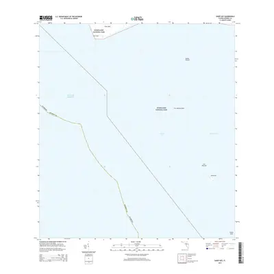
2015 Map of Sandy Key
USGS Topo · Published 2015About this map
Everglades National Park encompasses the vast majority of this maritime survey, illustrating the complex transition between the Florida mainland and the open sea. At the northern edge, the coastal reach of Cape Sable and East Cape marks the southernmost extent of the continental United States. The map focuses heavily on the submerged and semi-submerged geography of Florida Bay, where a network of shoals and banks like Middle Ground, First National Bank, and Oxfoot Bank define the nautical landscape. Small, isolated landforms such as Sandy Key and Carl Ross Key provide rare points of elevation amidst the tidal flats and shallows. This 2015 edition serves as a precise record of the shoreline and bathymetric features within Monroe County, tracing the subtle boundaries where the Gulf of Mexico meets the protected wilderness of the Florida coast.
Find a feature on this map
13 named features on this map. Tap any name to fly to it.
Don’t see what you’re looking for? This feature index may not catch every label — zoom into the map to look around manually.
Map Details
Editions of this 2015 Sandy Key Map
This is the sole edition of this map. No revisions or reprints were ever made.
Other maps of this area

1956 · Miami
USGS Topo · 1:250,000

1958 · Miami
USGS Topo · 1:250,000

1972 · Schooner Bank
USGS Topo · 1:24,000

1972 · East Bahia Honda Key NE
USGS Topo · 1:24,000

1972 · Lake Ingraham East
USGS Topo · 1:24,000
1972 · Lake Ingraham West
USGS Topo · 1:24,000

1972 · Sandy Key
USGS Topo · 1:24,000

1972 · Clive Key
USGS Topo · 1:24,000
1973 · Flamingo
USGS Topo · 1:24,000

1981 · Cape Sable
USGS Topo · 1:100,000