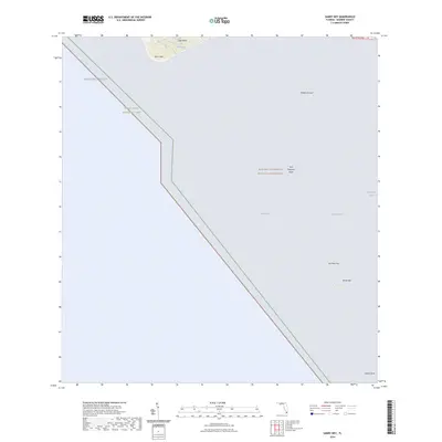
2024 Map of Sandy Key
USGS Topo · Published 2024About this map
Everglades National Park dominates this coastal survey, where the terrestrial tip of The Everglades meets the shallow waters of Florida Bay. The map highlights the remote southwestern edge of mainland Florida, featuring the prominent shoreline of Cape Sable and East Cape as they front the Gulf of Mexico. This area is preserved within the Marjory Stoneman Douglas Wilderness, a landscape defined by shifting shoals and tidal flats rather than human infrastructure. Navigational features and named underwater banks are essential to this marine-heavy sheet, including the curiously named First National Bank and the sprawling Middle Ground. To the southeast, isolated landforms such as Sandy Key and Carl Ross Key provide critical reference points for the deep Rocky Channel and Sandy Key Basin. The absence of roads or settlements underscores the wilderness character of this protected mangrove and coastal ecosystem.
Find a feature on this map
14 named features on this map. Tap any name to fly to it.
Don’t see what you’re looking for? This feature index may not catch every label — zoom into the map to look around manually.
Map Details
Editions of this 2024 Sandy Key Map
This is the sole edition of this map. No revisions or reprints were ever made.
Other maps of this area

1956 · Miami
USGS Topo · 1:250,000

1958 · Miami
USGS Topo · 1:250,000

1972 · Schooner Bank
USGS Topo · 1:24,000

1972 · East Bahia Honda Key NE
USGS Topo · 1:24,000

1972 · Lake Ingraham East
USGS Topo · 1:24,000
1972 · Lake Ingraham West
USGS Topo · 1:24,000

1972 · Sandy Key
USGS Topo · 1:24,000

1972 · Clive Key
USGS Topo · 1:24,000
1973 · Flamingo
USGS Topo · 1:24,000

1981 · Cape Sable
USGS Topo · 1:100,000