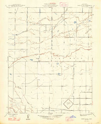
1948 Map of Sandy Mush
USGS Topo · Published 1948About this map
Sandy Mush is characterized by an intricate network of irrigation and drainage infrastructure within the Central Valley of California. This late-1940s landscape shows the transition of the arid terrain into productive agricultural land, managed through features like the Steiner Lateral, Casebeer Lateral, and Deane Canal. The natural hydrology of the area is defined by the winding paths of Owens Creek, Duck Slough, and Deadman Creek, which bisect the grid-patterned sections of the valley.
Find a feature on this map
22 named features on this map. Tap any name to fly to it.
Don’t see what you’re looking for? This feature index may not catch every label — zoom into the map to look around manually.
Map Details
Editions of this 1948 Sandy Mush Map
This is the sole edition of this map. No revisions or reprints were ever made.
Other maps of this area

1914 · Merced
USGS Topo · 1:31,680

1916 · Santa Rita Bridge
USGS Topo · 1:24,000

1916 · Delta Ranch
USGS Topo · 1:24,000

1917 · Merced
USGS Topo · 1:31,680

1918 · Arena
USGS Topo · 1:31,680

1918 · Bliss Ranch
USGS Topo · 1:31,680

1918 · Lingard
USGS Topo · 1:31,680

1918 · Atwater
USGS Topo · 1:31,680

1918 · Sandy Mush
USGS Topo · 1:31,680

1918 · Turner Ranch
USGS Topo · 1:31,680