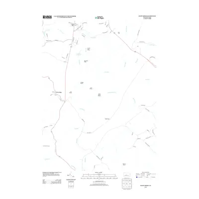
2013 Map of Sandy Ridge
USGS Topo · Published 2013About this map
Glass City and Powelton anchor this 2013 topographical survey of the high ground between the Moshannon Cr and the numerous runs that drain the eastern slopes. The landscape is defined by its deep hollows and prominent ridges, most notably Sandy Ridge itself, which rises to a Summit marked by the Sandy Ridge Fire Tower. Water management for the surrounding region is evident at the Philipsburg Reservoir, which captures the upper reaches of Cold Stream. The road network, including Old Tyrone Pike and Bald Eagle Pike, reflects the historical paths carved through these gaps. Minor settlements like Retort and Mapleton Junction suggest the industrial and transit heritage of the area, while names like Crowns Nest Hollow and Cabbage Hollow speak to the local vernacular naming traditions of the Pennsylvania highlands.
Find a feature on this map
69 named features on this map. Tap any name to fly to it.
Don’t see what you’re looking for? This feature index may not catch every label — zoom into the map to look around manually.
Map Details
Editions of this 2013 Sandy Ridge Map
This is the sole edition of this map. No revisions or reprints were ever made.
Other maps of this area

1903 · Houtzdale
USGS Topo · 1:62,500

1905 · Houtzdale
USGS Topo · 1:62,500

1920 · Altoona
USGS Topo · 1:62,500

1922 · Philipsburg
USGS Topo · 1:62,500

1922 · Altoona
USGS Topo · 1:62,500

1923 · Tyrone
USGS Topo · 1:62,500

1929 · Tyrone
USGS Topo · 1:48,000

1933 · Tyrone
USGS Topo · 1:62,500

1939 · Philipsburg
USGS Topo · 1:62,500

1944 · Houtzdale
USGS Topo · 1:24,000