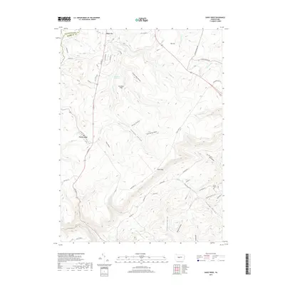
2019 Map of Sandy Ridge
USGS Topo · Published 2019About this map
Sandy Ridge and Glass City sit at the intersection of a complex valley system where the Clearfield and Centre County line divides the landscape. This 2019 survey illustrates a highland region defined by deep drainage patterns and named hollows like Crowns Nest Hollow and Seven Springs Hollow. The hydrology is particularly prominent, centered on the Philipsburg Reservoir and various tributaries such as Cold Stream and Tomtit Run that carve through Horseback Ridge. To the southeast, the landscape transitions into steep, narrow corridors like Fowler Hollow and California Hollow. Local history is preserved in landmarks such as the Mount Pleasant Cemetery and historical thoroughfares like the Old Tyrone Pike and Hannah Furnace Road, which point to the area’s early industrial and transport roots within Rush Township.
Find a feature on this map
65 named features on this map. Tap any name to fly to it.
Don’t see what you’re looking for? This feature index may not catch every label — zoom into the map to look around manually.
Map Details
Editions of this 2019 Sandy Ridge Map
This is the sole edition of this map. No revisions or reprints were ever made.
Other maps of this area

1903 · Houtzdale
USGS Topo · 1:62,500

1905 · Houtzdale
USGS Topo · 1:62,500

1920 · Altoona
USGS Topo · 1:62,500

1922 · Philipsburg
USGS Topo · 1:62,500

1922 · Altoona
USGS Topo · 1:62,500

1923 · Tyrone
USGS Topo · 1:62,500

1929 · Tyrone
USGS Topo · 1:48,000

1933 · Tyrone
USGS Topo · 1:62,500

1939 · Philipsburg
USGS Topo · 1:62,500

1944 · Houtzdale
USGS Topo · 1:24,000