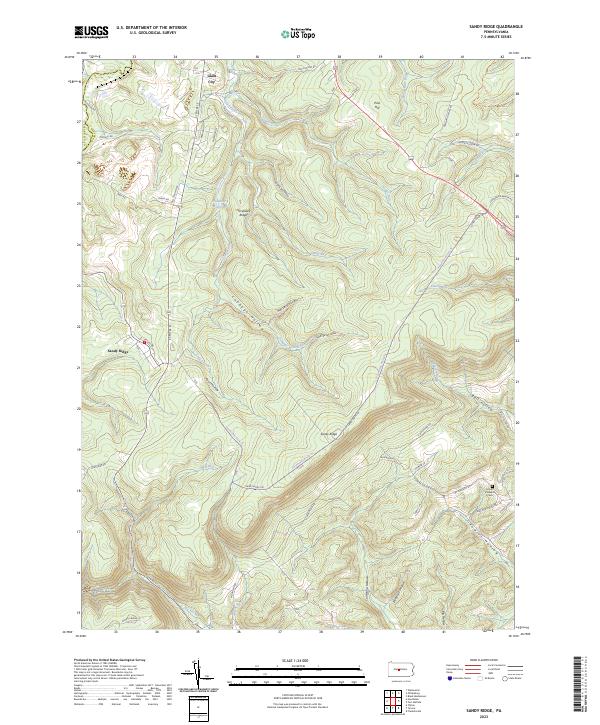
2023 Map of Sandy Ridge
USGS Topo · Published 2023About this map
The high plateau of the Allegheny Front dominates this terrain on the border of Centre Co and Clearfield Co. Small settlements like Sandy Ridge and Glass City sit along the winding path of S Centre St and Old Tyrone Pike, serving as hubs for a landscape deeply etched by cold-water drainages. The Philipsburg Reservoir is a central landmark among the ridges, collecting waters that flow through the diverse hollows of the region, such as Cabbage Hollow and Pool Hollow.
Find a feature on this map
57 named features on this map. Tap any name to fly to it.
Don’t see what you’re looking for? This feature index may not catch every label — zoom into the map to look around manually.
Map Details
Editions of this 2023 Sandy Ridge Map
This is the sole edition of this map. No revisions or reprints were ever made.
Other maps of this area

1903 · Houtzdale
USGS Topo · 1:62,500

1905 · Houtzdale
USGS Topo · 1:62,500

1920 · Altoona
USGS Topo · 1:62,500

1922 · Philipsburg
USGS Topo · 1:62,500

1922 · Altoona
USGS Topo · 1:62,500

1923 · Tyrone
USGS Topo · 1:62,500

1929 · Tyrone
USGS Topo · 1:48,000

1933 · Tyrone
USGS Topo · 1:62,500

1939 · Philipsburg
USGS Topo · 1:62,500

1944 · Houtzdale
USGS Topo · 1:24,000