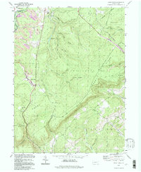
1994 Map of Sandy Ridge
USGS Topo · Published 1997About this map
The ridge-and-valley landscape of the Allegheny Front defines this 1990s record of the border between Clearfield and Centre Counties. The settlement at Sandy Ridge serves as a central point for the region's transport history, where the Conrail line and an Old Railroad Grade navigate the steep ascent of Sandy Ridge. To the north, the industrial footprint of extractive mining is visible through numerous Strip Mines and other extraction sites that pockmark the terrain near Glass City.
Find a feature on this map
48 named features on this map. Tap any name to fly to it.
Don’t see what you’re looking for? This feature index may not catch every label — zoom into the map to look around manually.
Map Details
Editions of this 1994 Sandy Ridge Map
This is the sole edition of this map. No revisions or reprints were ever made.
Other maps of this area

1903 · Houtzdale
USGS Topo · 1:62,500

1905 · Houtzdale
USGS Topo · 1:62,500

1920 · Altoona
USGS Topo · 1:62,500

1922 · Philipsburg
USGS Topo · 1:62,500

1922 · Altoona
USGS Topo · 1:62,500

1923 · Tyrone
USGS Topo · 1:62,500

1929 · Tyrone
USGS Topo · 1:48,000

1933 · Tyrone
USGS Topo · 1:62,500

1939 · Philipsburg
USGS Topo · 1:62,500

1944 · Houtzdale
USGS Topo · 1:24,000