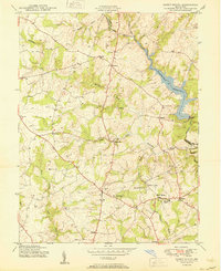
1950 Map of Sandy Spring
USGS Topo · Published 1950About this map
Sandy Spring and the surrounding Maryland countryside appear in mid-century detail, revealing a landscape of established crossroads communities and developing infrastructure. The map highlights central institutions like the Montgomery County General Hospital and Sherwood High Sch, illustrating the area's growth as a hub for local services. To the east, the Triadelphia Reservoir is a dominant water feature, held by the Brighton Dam at the Patuxent River boundary between Montgomery and Howard counties.
Find a feature on this map
29 named features on this map. Tap any name to fly to it.
Don’t see what you’re looking for? This feature index may not catch every label — zoom into the map to look around manually.
Map Details
Editions of this 1950 Sandy Spring Map
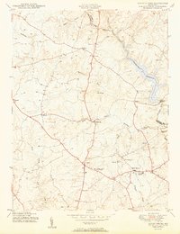
2 editions found
Other maps of this area

1892 · Laurel
USGS Topo · 1:62,500

1892 · Ellicott
USGS Topo · 1:62,500

1893 · Frederick
USGS Topo · 1:125,000

1894 · Ellicott
USGS Topo · 1:62,500

1894 · Laurel
USGS Topo · 1:62,500

1894 · Frederick
USGS Topo · 1:125,000

1897 · Laurel
USGS Topo · 1:62,500

1906 · Ellicott
USGS Topo · 1:62,500

1907 · Laurel
USGS Topo · 1:62,500

1908 · Patapsco
USGS Topo · 1:125,000