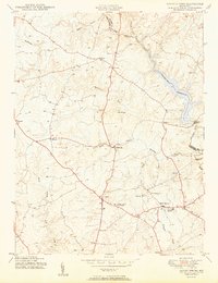
1950 Map of Sandy Spring
USGS Topo · Published 1950About this map
The Triadelphia Reservoir dominates the northeastern corner of this landscape, created by the Brighton Dam on the Patuxent River. This 1950 survey captures a region of Montgomery County defined by crossroads hamlets and emerging institutional hubs before the heavy suburbanization of the late 20th century. Major intersections like Olney and Ashton are clearly mapped, alongside historic centers such as Brookeville and Sandy Spring.
Find a feature on this map
29 named features on this map. Tap any name to fly to it.
Don’t see what you’re looking for? This feature index may not catch every label — zoom into the map to look around manually.
Map Details
Editions of this 1950 Sandy Spring Map
2 editions found
Other maps of this area

1892 · Laurel
USGS Topo · 1:62,500

1892 · Ellicott
USGS Topo · 1:62,500

1893 · Frederick
USGS Topo · 1:125,000

1894 · Ellicott
USGS Topo · 1:62,500

1894 · Laurel
USGS Topo · 1:62,500

1894 · Frederick
USGS Topo · 1:125,000

1897 · Laurel
USGS Topo · 1:62,500

1906 · Ellicott
USGS Topo · 1:62,500

1907 · Laurel
USGS Topo · 1:62,500

1908 · Patapsco
USGS Topo · 1:125,000