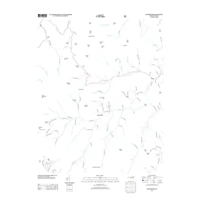
2013 Map of Sandymush
USGS Topo · Published 2013About this map
Newfound Mountain anchors the southern landscape of this 2013 topographical survey, where the drainages of Sandymush Cr and its many branches define a complex network of deep coves and ridges. The small settlements of Sandymush, Luck, and Canto are situated along these winding watercourses, connected by rural routes such as Bald Creek Rd and School Rd. The terrain is marked by numerous family-named landmarks and geographic features like Plemmons Cove, Reynolds Cove, and Greasy Cove, illustrating the long-standing community ties to specific mountain hollows.
Find a feature on this map
143 named features on this map. Tap any name to fly to it.
Don’t see what you’re looking for? This feature index may not catch every label — zoom into the map to look around manually.
Map Details
Editions of this 2013 Sandymush Map
This is the sole edition of this map. No revisions or reprints were ever made.
Other maps of this area

1894 · Asheville
USGS Topo · 1:125,000

1901 · Asheville
USGS Topo · 1:125,000

1935 · Canton
USGS Topo · 1:24,000

1935 · Clyde
USGS Topo · 1:24,000

1935 · Spring Creek
USGS Topo · 1:24,000

1935 · Lemon Gap
USGS Topo · 1:24,000

1936 · Marshall
USGS Topo · 1:24,000

1936 · Sandymush
USGS Topo · 1:24,000

1936 · Enka
USGS Topo · 1:24,000

1936 · Hepco
USGS Topo · 1:24,000