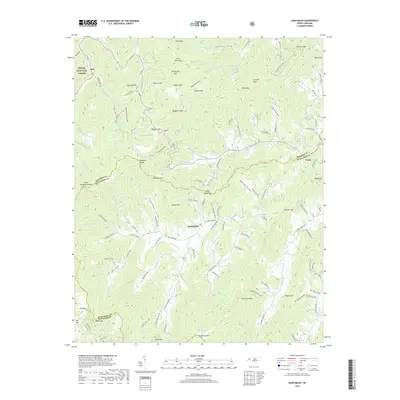
2019 Map of Sandymush
USGS Topo · Published 2019About this map
Sandymush and the surrounding high ridges of the Blue Ridge define this landscape at the intersection of Madison, Buncombe, and Haywood counties. This area is characterized by an intricate network of coves and gaps, where small settlements like Luck and Canto are linked by winding roads such as Big Sandy Mush Rd and State Rd 1162. The terrain is steeply defined by summits like Newfound Mtn and Little Sandymush Bald, with numerous watercourses including Little Sandymush Cr and N Turkey Cr carving through the valleys. Much of the western portion of the map is protected within the Pisgah National Forest, preserving the natural drainage patterns of Robinson Laurel and Tug Fork. The map documents a rural Appalachian community where legacy place names like Doggett Knob and Plemmons Cove reflect long-standing local geography.
Find a feature on this map
126 named features on this map. Tap any name to fly to it.
Don’t see what you’re looking for? This feature index may not catch every label — zoom into the map to look around manually.
Map Details
Editions of this 2019 Sandymush Map
This is the sole edition of this map. No revisions or reprints were ever made.
Other maps of this area

1894 · Asheville
USGS Topo · 1:125,000

1901 · Asheville
USGS Topo · 1:125,000

1935 · Canton
USGS Topo · 1:24,000

1935 · Clyde
USGS Topo · 1:24,000

1935 · Spring Creek
USGS Topo · 1:24,000

1935 · Lemon Gap
USGS Topo · 1:24,000

1936 · Marshall
USGS Topo · 1:24,000

1936 · Sandymush
USGS Topo · 1:24,000

1936 · Enka
USGS Topo · 1:24,000

1936 · Hepco
USGS Topo · 1:24,000