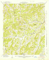
1942 Map of Sandymush
USGS Topo · Published 1942About this map
The Pisgah National Forest covers much of this high mountain landscape in the early 1940s, a region defined by sharp ridges and narrow coves where Madison and Buncombe counties meet. Settlement is concentrated along the winding watercourses of Sandymush Creek and Little Pine Creek, where numerous rural congregations serve the mountain communities. Many of these churches, such as Crossrock Ch, Payne Chapel, and Ebenezer Ch, are located near gap crossings like Doggett Gap and Hickorynut Gap. The terrain is characterized by prominent knobs including Mikes Knob and Pinnacle Knob, illustrating the difficult topography of the Newfound Mountain and Crabtree areas. This map shows the traditional land-use patterns of the Blue Ridge before modern development, marking isolated settlements like Luck and Canto along the valley roads.
Find a feature on this map
85 named features on this map. Tap any name to fly to it.
Don’t see what you’re looking for? This feature index may not catch every label — zoom into the map to look around manually.
Map Details
Editions of this 1942 Sandymush Map
This is the sole edition of this map. No revisions or reprints were ever made.
Other maps of this area

1894 · Asheville
USGS Topo · 1:125,000

1901 · Asheville
USGS Topo · 1:125,000

1935 · Canton
USGS Topo · 1:24,000

1935 · Clyde
USGS Topo · 1:24,000

1935 · Spring Creek
USGS Topo · 1:24,000

1935 · Lemon Gap
USGS Topo · 1:24,000

1936 · Marshall
USGS Topo · 1:24,000

1936 · Sandymush
USGS Topo · 1:24,000

1936 · Enka
USGS Topo · 1:24,000

1936 · Hepco
USGS Topo · 1:24,000