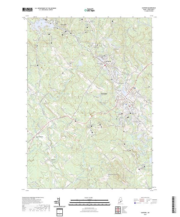
2024 Map of Sanford
USGS Topo · Published 2024About this map
Sanford and the adjacent industrial village of Springvale serve as the primary hubs of this modern-day topographic study in York County. The Mousam River winds through these centers, historically powering the region's development and connecting the northern waters of Mousam Lake to the various mills that once defined the local economy. The landscape is notably dense with genealogical interest, containing dozens of small burial grounds and family-named cemeteries such as the Bennett Moulton Swett Cemetery and the Tebbets-Jones-Phillips Cemetery, which reflect generations of family farming and land ownership.
Find a feature on this map
227 named features on this map. Tap any name to fly to it.
Don’t see what you’re looking for? This feature index may not catch every label — zoom into the map to look around manually.
Map Details
Editions of this 2024 Sanford Map
This is the sole edition of this map. No revisions or reprints were ever made.
Other maps of this area

1891 · Berwick
USGS Topo · 1:62,500

1891 · Kennebunk
USGS Topo · 1:62,500

1891 · Buxton
USGS Topo · 1:62,500

1891 · Newfield
USGS Topo · 1:62,500

1892 · Buxton
USGS Topo · 1:62,500

1893 · Kennebunk
USGS Topo · 1:62,500

1893 · Berwick
USGS Topo · 1:62,500

1893 · Buxton
USGS Topo · 1:62,500

1893 · Newfield
USGS Topo · 1:62,500

1898 · Kennebunk
USGS Topo · 1:62,500