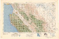
1957 Map of Santa Cruz
USGS Topo · Published 1957About this map
Monterey Bay serves as the focal point for this mid-century survey, anchoring a coastal landscape that transitions from the fishing and tourism hubs of Monterey and Santa Cruz into the deep interior of the San Joaquin Valley. The map illustrates a California in the midst of post-war expansion, where the agricultural corridors of the Salinas River valley connect established towns like Salinas and Soledad with the rising oil and gas interests near Coalinga and Avenal.
Find a feature on this map
58 named features on this map. Tap any name to fly to it.
Don’t see what you’re looking for? This feature index may not catch every label — zoom into the map to look around manually.
Map Details
Editions of this 1957 Santa Cruz Map
This is the sole edition of this map. No revisions or reprints were ever made.
Other maps of this area

1902 · Santa Cruz
USGS Topo · 1:125,000

1910 · Gonzales
USGS Topo · 1:31,680

1910 · Salinas
USGS Topo · 1:31,680

1910 · Soledad
USGS Topo · 1:31,680

1912 · Salinas
USGS Topo · 1:62,500

1912 · Coalinga
USGS Topo · 1:125,000

1912 · San Ardo
USGS Topo · 1:31,680

1912 · Metz
USGS Topo · 1:31,680

1912 · Mariposa
USGS Topo · 1:125,000

1912 · Capitola
USGS Topo · 1:62,500