Old Maps of Gilroy, California
Explore 42 old maps of Gilroy, spanning from 1915 to today. These high-resolution historic maps reveal how streets, neighborhoods, landmarks, and natural features evolved over time — perfect for genealogy, metal detecting, research, and local history exploration.
What you can do with these maps:
- See how Gilroy changed over time: Compare historical maps to modern-day views to trace roads, homesites, rail lines & more.
- View detailed metadata: Each map includes creators, publishers, year, scale, and archive source.
- Overlay maps with satellite & LiDAR: Visualize the past alongside modern tools to explore terrain & human change.
- Trusted historical sources: Maps sourced from the USGS, Library of Congress, and other archives.
- Access maps your way: View online, download high-res files, or order prints for personal or research use.
Start exploring old maps of Gilroy to uncover forgotten places, hidden landmarks, and the deep history beneath your feet.
Gilroy, CA maps
(42)- 1915 Map of San Juan Bautista
 1915 San Juan Bautista1915 Print · USGSCentral Coast agriculture and railroad expansion converge in this 1910s study of the Pajaro Valley. Local historians can trace the Southern Pacific line past Watsonville Junction to the Mission San Juan Bautista.
 - 1917 Map of Morgan Hill
 1917 Morgan Hill1917 Print · USGSSanta Clara County during the early twentieth century is captured here as a valley of orchards and growing rail towns. Genealogists can locate specific family sites like Bradleys Store or trace rural attendance at Machado School and Uvas School.5 unique versions available
 - 1917 Map of San Juan Bautista
 1917 San Juan Bautista1917 Print · USGSThe fertile valleys of the Central Coast meet at the foot of the Santa Cruz Mountains during this era of agricultural expansion. Genealogists can trace family names across huge land grants and locate historic sites like Mission San Juan Bautista and the St Francis Orphan Asylum.6 unique versions available
 - 1939 Map of Morgan Hill, 1957 Print
 1939 Morgan Hill1957 Print · USGSSanta Clara County at the end of the 1930s shows a valley of orchards and ranchlands along the Southern Pacific line. Researchers can trace early school districts at Burnett School and Llagas School, or find vanished community hubs like Bradley Store and the original Old Gilroy.2 unique versions available
 - 1939 Map of San Juan Bautista, 1958 Print
 1939 San Juan Bautista1958 Print · USGSThe Central Coast landscape at the dawn of World War II is documented here, showing the intersection of Spanish-era ranchos and the Southern Pacific rail line. Researchers can trace the grounds of Mission San Juan Bautista, identify the Sargent Oil Field, and locate numerous rural schoolhouses like Carlton School.
 - 1940 Map of San Juan Bautista
 1940 San Juan Bautista1940 Print · USGSCentral California coastal and valley life at the start of the 1940s is captured here, where four counties meet. Genealogy researchers can trace family-named sites like Patrick Breen, old rural institutions like the St Francis Orphan Asylum, and the early Sargent Oil Fields.
 - 1941 Map of Morgan Hill
 1941 Morgan Hill1941 Print · USGSThe Santa Clara Valley corridor comes alive in the early 1940s, showing a landscape of ranchos and rail-side towns. Trace family roots at Redwood School or find old landmarks like Bradley's Store and Madrone Soda Springs.
 - 1947 Map of San Jose, 1948 Print
 1947 San Jose1948 Print · USGSNorthern California's heartland is captured here just after the war, showing the rapid growth of the Santa Clara and Central Valleys. Researchers can trace the legacy of rail and water at Castle Air Force Base, Stockton, and the Hetch Hetchy Aqueduct.
 - 1948 Map of Santa Cruz
 1948 Santa Cruz1948 Print · USGSThe Central Coast and San Joaquin Valley meet in this mid-century look at the region's agricultural and military geography. Genealogists and historians can trace the paths of El Camino Real, locate family farms near Hollister, or study the footprint of the Fort Ord Military Reservation.2 unique versions available
 - 1955 Map of Santa Cruz
 1955 Santa Cruz1955 Print · USGSCoastal Monterey Bay and the fertile Salinas Valley are captured here during the post-war expansion of the mid-fifties. Researchers can trace the era's rail-and-road network via the Southern Pacific lines and find landmarks like Fort Ord or the Lonoak School.
 - 1955 Map of Chittenden, 1956 Print
 1955 Chittenden1956 Print · USGSThe junction of Santa Clara, Santa Cruz, and San Benito counties comes alive in this mid-fifties study of the Pajaro River corridor. Researchers can trace the Southern Pacific rail line through Pajaro Gap to find early settlements like Sargent and Chittenden.10 unique versions available
 - 1955 Map of Mt. Madonna, 1956 Print
 1955 Mt. Madonna1956 Print · USGSThe Santa Clara Valley and Santa Cruz Mountains meet in this mid-fifties study of growing towns and rugged parklands. Genealogists and local historians can trace the foundations of Morgan Hill, the secluded Redwood Retreat, and historic rural landmarks like Machado School.6 unique versions available
 - 1955 Map of Watsonville East, 1956 Print
 1955 Watsonville East1956 Print · USGSThe fertile Pajaro Valley and southern Santa Cruz Mountains are seen here in the mid-fifties, centered on a vital agricultural and rail corridor. Genealogists and local historians can trace family sites near Johnston Corner, the Pajaro Valley Memorial Park, and the Southern Pacific hub at Watsonville Junction.6 unique versions available
 - 1955 Map of Gilroy, 1956 Print
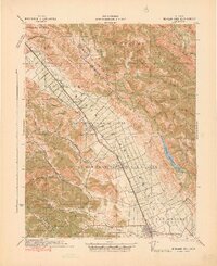
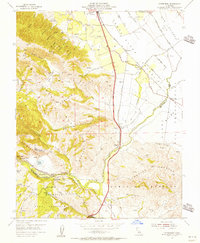
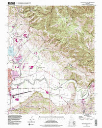
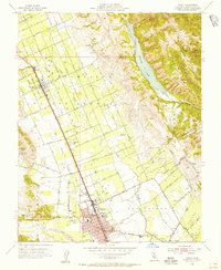 1955 Gilroy1956 Print · USGSThe Santa Clara Valley’s orchard and rail corridor are captured here during the mid-fifties, centered on the city of Gilroy. Genealogists and historians can trace early schools like Glen View Sch and San Ysidro Sch, alongside the tracks of the Southern Pacific.7 unique versions available
 - 1956 Map of San Jose
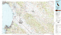
 1956 San Jose1956 Print · USGSCentral California in the mid-fifties reveals the transition from sprawling orchards to growing urban hubs like San Jose and Stockton. Genealogists and historians can trace the rail-era landscape of the Mother Lode through Chinese Camp and Tuttletown, or follow the water through the Joaquin River and Calaveras Reservoir.
 - 1957 Map of Santa Cruz
 1957 Santa Cruz1957 Print · USGSCentral California comes into sharp focus during the late fifties, from the fog-swept Monterey Bay to the sun-drenched San Joaquin Valley. Genealogists and historians can trace the mid-century footprints of Fort Ord Military Reservation, the Southern Pacific line, and the historic streets of San Juan Bautista.
 - 1958 Map of Santa Cruz
 1958 Santa Cruz1958 Print · USGSCoastal California and the central valleys are shown during the mid-fifties, capturing a landscape of massive military reserves and vital rail arteries. Genealogists and historians can trace the Southern Pacific line through Salinas or explore the early footprints of the Fort Ord Military Reservation and San Juan Bautista.2 unique versions available
 - 1962 Map of San Jose
 1962 San Jose1962 Print · USGSCentral California in the early sixties showcases the expansion of the San Joaquin and Santa Clara valleys. Researchers can trace the rail-to-road transition along the Southern Pacific RR or locate landmarks like Castle USAF Base and Loma Prieta.4 unique versions available
 - 1965 Map of Santa Cruz, 1968 Print
 1965 Santa Cruz1968 Print · USGSThe Central Coast and San Joaquin Valley meet here during the mid-sixties, capturing the growth of agricultural and coastal hubs. Trace the historic Southern Pacific RR lines and locate sites like the Presidio of Monterey or Pinnacles National Monument.
 - 1966 Map of San Jose
 1966 San Jose1966 Print · USGSCentral California in the mid-1960s reveals a landscape of massive irrigation projects and expanding Cold War military footprints. Researchers can trace the rail-and-river network of the San Joaquin Valley or locate specialized sites like Castle Air Force Base and the Sharp General Depot (Military).
 - 1973 Map of Gilroy, 1979 Print
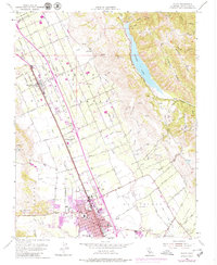 1973 Gilroy1979 Print · USGSThe Santa Clara Valley transitions from agrarian roots to suburban growth in the early seventies. Genealogists can locate family names and sites like Sun Martin, St Marys Sch, and the Southern Pacific rail line.
 - 1974 Map of Monterey, 1977 Print
 1974 Monterey1977 Print · USGSThe Central Coast and San Joaquin Valley meet in this mid-seventies survey of the Monterey region. Genealogists and historians can locate Spanish-era sites like the San Antonio de Padua Mission, early industrial markers such as the New Idria Mine, and coastal landmarks like the Point Sur Lighthouse.
 - 1978 Map of San Jose
 1978 San Jose1978 Print · USGSSanta Clara County and the East Bay hills are captured in the late seventies, showing the suburban sprawl of San Jose alongside the rural Central Valley. Trace the paths of the Southern Pacific railroad and find landmarks like New Almaden and Lick Observatory.
 - 1983 Map of Monterey, 1984 Print
 1983 Monterey1984 Print · USGSCoastal Monterey and the Salinas Valley appear in the early eighties as a hub of military activity and deep-rooted agriculture. Researchers can trace historic land grant boundaries like Rancho Buena Vista or locate sites like Mission San Juan Bautista and Spreckels.2 unique versions available
 - 1995 Map of Watsonville East, 1998 Print
 1995 Watsonville East1998 Print · USGSCoastal agriculture and mountainous terrain meet in the Pajaro Valley during the mid-nineties. Researchers can trace the Southern Pacific rail corridor through Watsonville Junction or locate family sites at Pajaro Valley Memorial Park and Johnston Corner.2 unique versions available
Showing maps 1-25 of 42
Top cities near Gilroy
- San Jose historical maps
- Watsonville historical maps
- Morgan Hill historical maps
- Hollister historical maps
- Prunedale historical maps
- Pajaro historical maps
See more
Top neighborhoods of Gilroy
Frequently asked questions
- What are the different types of historical maps available for Gilroy?
- What is the oldest map of Gilroy?
- Where can I purchase historical maps of Gilroy for my home or office?
- Where can I download high-res historical maps of Gilroy?
- Are there historical topographic maps available for Gilroy?
- Is there historical aerial imagery available for Gilroy?
- Where are historical maps of Gilroy sourced from?