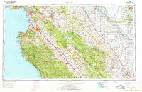
1965 Map of Santa Cruz
USGS Topo · Published 1968About this map
The Central Coast of California meets the agricultural heartland in this mid-1960s survey, detailing the geographic transition from the Pacific shoreline to the San Joaquin Valley. Coastal centers like Santa Cruz, Monterey, and Salinas are shown in their period of mid-century expansion, while the interior landscape is dominated by the Gabilan Range and the Santa Lucia Range. The presence of the Southern Pacific RR and major arteries like U S Highway 101 illustrates the infrastructure supporting the region's produce and transport economy.
Find a feature on this map
120 named features on this map. Tap any name to fly to it.
Don’t see what you’re looking for? This feature index may not catch every label — zoom into the map to look around manually.
Map Details
Editions of this 1965 Santa Cruz Map
This is the sole edition of this map. No revisions or reprints were ever made.
Other maps of this area

1902 · Santa Cruz
USGS Topo · 1:125,000

1910 · Gonzales
USGS Topo · 1:31,680

1910 · Salinas
USGS Topo · 1:31,680

1910 · Soledad
USGS Topo · 1:31,680

1912 · Salinas
USGS Topo · 1:62,500

1912 · Coalinga
USGS Topo · 1:125,000

1912 · San Ardo
USGS Topo · 1:31,680

1912 · Metz
USGS Topo · 1:31,680

1912 · Mariposa
USGS Topo · 1:125,000

1912 · Capitola
USGS Topo · 1:62,500