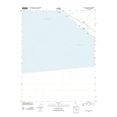
2012 Map of Santa Cruz OE W
USGS Topo · Published 2012About this map
The coastal shelf of Santa Cruz County meets the Pacific Ocean in this detailed survey, documenting a stretch of shoreline defined by sharp bluffs and seasonal drainages. Small settlements and coastal outposts like Majors and Gordola are situated along the historic corridor of Coast Rd, where the landscape transitions from the marine environment to agricultural and residential parcels. The map meticulously records the rugged interface of land and sea, identifying specific geographic landmarks such as Sand Hill Bluff and the prominent Table Rock.
Find a feature on this map
15 named features on this map. Tap any name to fly to it.
Don’t see what you’re looking for? This feature index may not catch every label — zoom into the map to look around manually.
Map Details
Editions of this 2012 Santa Cruz OE W Map
This is the sole edition of this map. No revisions or reprints were ever made.
Other maps of this area

1902 · Santa Cruz
USGS Topo · 1:125,000

1940 · Ano Nuevo
USGS Topo · 1:62,500

1941 · Ano Nuevo Pt.
USGS Topo · 1:62,500

1942 · Ano Nuevo
USGS Topo · 1:62,500

1947 · San Francisco
USGS Topo · 1:250,000

1948 · Santa Cruz
USGS Topo · 1:250,000

1948 · San Francisco
USGS Topo · 1:250,000

1948 · Ano Nuevo
USGS Topo · 1:62,500
1954 · Santa Cruz
USGS Topo · 1:24,000

1955 · San Francisco
USGS Topo · 1:250,000