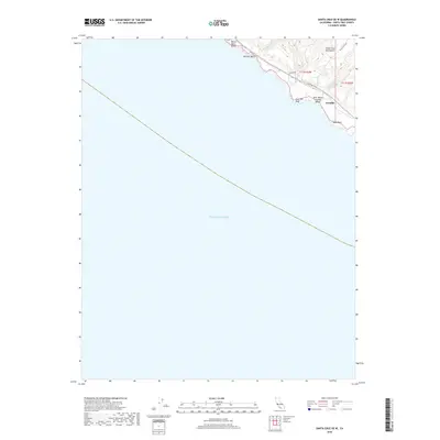
2018 Map of Santa Cruz OE W
USGS Topo · Published 2018About this map
Sand Hill Bluff and the jagged edge of Table Rock define a dramatic stretch of the California coast northwest of Santa Cruz. This 2018 survey details where the Santa Cruz Mountains meet the Pacific Ocean, a landscape of steep coastal drainages including Laguna Cr and Majors Cr. The small settlement of Gordola sits atop the marine terraces near the junction of Coast Rd and Back Ranch Rd, marking a transition from the rugged shoreline to the interior agricultural and woodland zones. Historically significant beaches such as Bonny Doon Beach, Panther Beach, and Red, White and Blue Beach are meticulously mapped along the surf line, providing a contemporary record of these public and private access points before further environmental change.
Find a feature on this map
16 named features on this map. Tap any name to fly to it.
Don’t see what you’re looking for? This feature index may not catch every label — zoom into the map to look around manually.
Map Details
Editions of this 2018 Santa Cruz OE W Map
This is the sole edition of this map. No revisions or reprints were ever made.
Other maps of this area

1902 · Santa Cruz
USGS Topo · 1:125,000

1940 · Ano Nuevo
USGS Topo · 1:62,500

1941 · Ano Nuevo Pt.
USGS Topo · 1:62,500

1942 · Ano Nuevo
USGS Topo · 1:62,500

1947 · San Francisco
USGS Topo · 1:250,000

1948 · Santa Cruz
USGS Topo · 1:250,000

1948 · San Francisco
USGS Topo · 1:250,000

1948 · Ano Nuevo
USGS Topo · 1:62,500
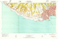
1954 · Santa Cruz
USGS Topo · 1:24,000

1955 · San Francisco
USGS Topo · 1:250,000