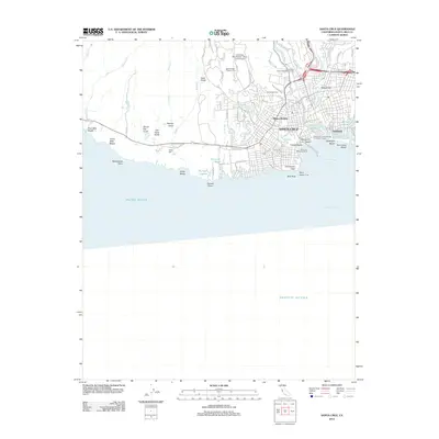
2012 Map of Santa Cruz
USGS Topo · Published 2012About this map
Santa Cruz is depicted here as a thriving coastal hub where the urban grid meets the Pacific shoreline and the Santa Cruz Mountains. The map highlights the unique circular street layout of The Circles near the coast, contrasting with the sprawling University of California - Santa Cruz Campus to the north. Historical sites like the Evergreen Cem and the Independent Order of Oddfellows Cem sit on the edge of the city's residential districts, while the iconic Santa Cruz Municipal Wharf and the Santa Cruz Looff Carousel and Roller Coaster define the beachfront economy. To the west, the landscape shifts abruptly to agricultural and protected lands, including Wilder State Park and the Agroecology Program Farm, showing the area's transition from academic and residential development to rugged coastal gulches like Peasley Gulch and Old Dairy Gulch.
Find a feature on this map
74 named features on this map. Tap any name to fly to it.
Don’t see what you’re looking for? This feature index may not catch every label — zoom into the map to look around manually.
Map Details
Editions of this 2012 Santa Cruz Map
This is the sole edition of this map. No revisions or reprints were ever made.
Other maps of this area

1902 · Santa Cruz
USGS Topo · 1:125,000

1912 · Capitola
USGS Topo · 1:62,500

1914 · Capitola
USGS Topo · 1:62,500

1916 · New Almaden
USGS Topo · 1:48,000

1919 · New Almaden
USGS Topo · 1:62,500

1940 · Capitola
USGS Topo · 1:62,500

1940 · Los Gatos
USGS Topo · 1:62,500

1943 · Los Gatos
USGS Topo · 1:62,500

1947 · San Francisco
USGS Topo · 1:250,000

1947 · San Jose
USGS Topo · 1:250,000