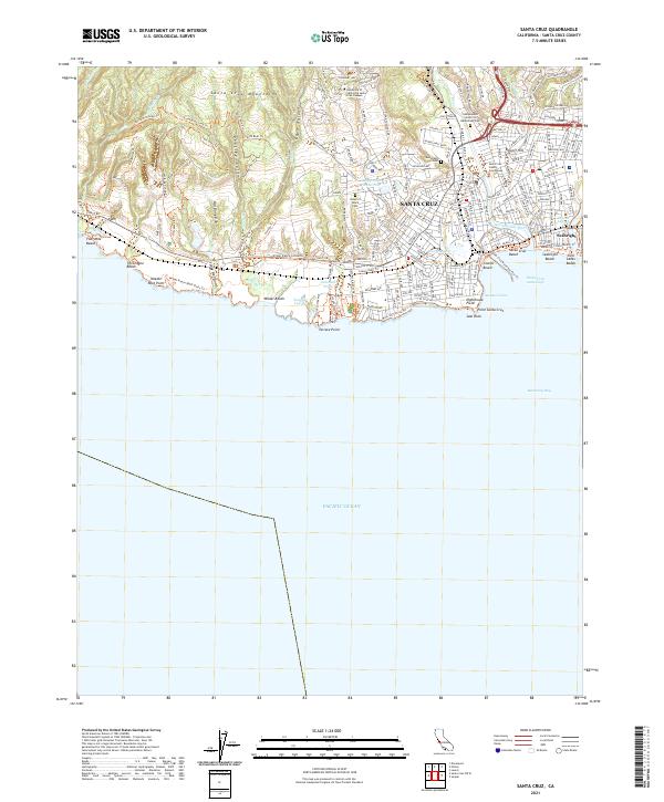
2021 Map of Santa Cruz
USGS Topo · Published 2021About this map
The University of California Santa Cruz Campus dominates the northern bluffs, overlooking a coastline defined by intricate ravines and established civic landmarks. Moving south from the foothills of the Santa Cruz Mountains, the landscape transitions from the deep incisions of Peasley Gulch and Cave Gulch into the dense street grid of Santa Cruz. The eastern edge is anchored by the San Lorenzo River, while the waterfront showcases a legacy of recreation and maritime identity, from the Santa Cruz Municipal Pier Trl to the world-renowned surf break at Steamer Lane.
Find a feature on this map
73 named features on this map. Tap any name to fly to it.
Don’t see what you’re looking for? This feature index may not catch every label — zoom into the map to look around manually.
Map Details
Editions of this 2021 Santa Cruz Map
This is the sole edition of this map. No revisions or reprints were ever made.
Other maps of this area

1902 · Santa Cruz
USGS Topo · 1:125,000

1912 · Capitola
USGS Topo · 1:62,500

1914 · Capitola
USGS Topo · 1:62,500

1916 · New Almaden
USGS Topo · 1:48,000

1919 · New Almaden
USGS Topo · 1:62,500

1940 · Capitola
USGS Topo · 1:62,500

1940 · Los Gatos
USGS Topo · 1:62,500

1943 · Los Gatos
USGS Topo · 1:62,500

1947 · San Francisco
USGS Topo · 1:250,000

1947 · San Jose
USGS Topo · 1:250,000