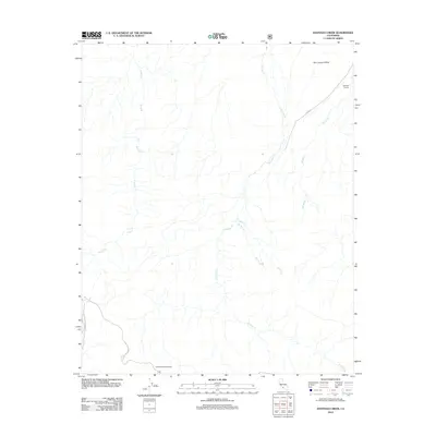
2012 Map of Santiago Creek
USGS Topo · Published 2012About this map
San Joaquin Valley transitions into the upland drainage basins of the southwestern edge of the valley floor in this 2012 record. The topography is defined by the complex branching of Santiago Cr, which is fed by E Twin Cr, W Twin Cr, and Muddy Cr. To the west, the deeply incised channel of Bitter Cr runs parallel to these systems. Human activity in this arid landscape is concentrated along sparse roadways like Cerro Noroeste Rd and Ballinger Canyon Rd. Significant landmarks for local history and recreation include the Santiago Corrals in the northeast and the Valle Vista Campground situated in the southern reaches of the quadrangle. The map illustrates a primarily undeveloped region where water management and seasonal grazing likely shaped the land use patterns near Cappello.
Find a feature on this map
11 named features on this map. Tap any name to fly to it.
Don’t see what you’re looking for? This feature index may not catch every label — zoom into the map to look around manually.
Map Details
Editions of this 2012 Santiago Creek Map
This is the sole edition of this map. No revisions or reprints were ever made.
Other maps of this area

1903 · Mt. Pinos
USGS Topo · 1:125,000

1910 · Buena Vista Lake
USGS Topo · 1:125,000

1912 · Buena Vista Lake
USGS Topo · 1:125,000

1931 · Pentland Junction
USGS Topo · 1:31,680

1931 · Hayes Ranch
USGS Topo · 1:31,680

1933 · Hayes Ranch
USGS Topo · 1:31,680

1934 · Pentland
USGS Topo · 1:31,680

1942 · Eagle Rest Peak
USGS Topo · 1:24,000

1942 · Ballinger Canyon
USGS Topo · 1:24,000

1943 · Maricopa
USGS Topo · 1:31,680