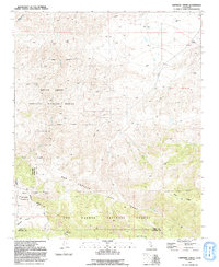
1991 Map of Santiago Creek
USGS Topo · Published 1991About this map
The San Andreas Rift Zone dominates the structural character of this landscape at the boundary of Kern Co and Ventura Co in the early 1990s. This survey illustrates a complex intersection of conservation lands and geologic activity, with the Bitter Creek National Wildlife Refuge and the Los Padres National Forest occupying much of the high-elevation terrain. The presence of Santiago Corrals and Valle Vista Campground suggests the area's use for recreation and ranching amid the dry canyons of San Emidio. Significant drainage systems like Santiago Creek and Ballinger Canyon carve through the sedimentary layers, while an isolated Oil Well near the northern border points to the industrial potential of the underlying geology. Modern access is marked by Noroeste Road, which traverses the varied elevations between the rift valley and the Blue Ridge.
Find a feature on this map
22 named features on this map. Tap any name to fly to it.
Don’t see what you’re looking for? This feature index may not catch every label — zoom into the map to look around manually.
Map Details
Editions of this 1991 Santiago Creek Map
This is the sole edition of this map. No revisions or reprints were ever made.
Other maps of this area

1903 · Mt. Pinos
USGS Topo · 1:125,000

1910 · Buena Vista Lake
USGS Topo · 1:125,000

1912 · Buena Vista Lake
USGS Topo · 1:125,000

1931 · Pentland Junction
USGS Topo · 1:31,680

1931 · Hayes Ranch
USGS Topo · 1:31,680

1933 · Hayes Ranch
USGS Topo · 1:31,680

1934 · Pentland
USGS Topo · 1:31,680

1942 · Eagle Rest Peak
USGS Topo · 1:24,000

1942 · Ballinger Canyon
USGS Topo · 1:24,000

1943 · Maricopa
USGS Topo · 1:31,680