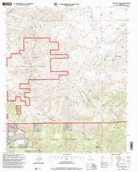
1995 Map of Santiago Creek
USGS Topo · Published 2000About this map
The San Andreas Rift Zone carves a clear geological path across this portion of the San Emigdio Mountains, marking a landscape defined by significant tectonic activity. This mid-1990s survey by the U.S. Geological Survey and Forest Service highlights a rugged intersection of public conservation and private land history, featuring the sprawling Bitter Creek National Wildlife Refuge and the northern reaches of the Los Padres National Forest.
Find a feature on this map
18 named features on this map. Tap any name to fly to it.
Don’t see what you’re looking for? This feature index may not catch every label — zoom into the map to look around manually.
Map Details
Editions of this 1995 Santiago Creek Map
This is the sole edition of this map. No revisions or reprints were ever made.
Other maps of this area

1903 · Mt. Pinos
USGS Topo · 1:125,000

1910 · Buena Vista Lake
USGS Topo · 1:125,000

1912 · Buena Vista Lake
USGS Topo · 1:125,000

1931 · Pentland Junction
USGS Topo · 1:31,680

1931 · Hayes Ranch
USGS Topo · 1:31,680

1933 · Hayes Ranch
USGS Topo · 1:31,680

1934 · Pentland
USGS Topo · 1:31,680

1942 · Eagle Rest Peak
USGS Topo · 1:24,000

1942 · Ballinger Canyon
USGS Topo · 1:24,000

1943 · Maricopa
USGS Topo · 1:31,680