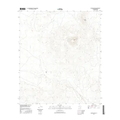
2016 Map of Santiago Peak
USGS Topo · Published 2016About this map
Santiago Peak dominates this high-elevation landscape in Brewster County, serving as the central landmark for the surrounding Santiago Mountains. The 2016 topography illustrates the dramatic vertical rise of the peak above the desert floor, where drainage patterns are defined by seasonal watercourses. Calamity Cr and Chalk Draw cut through the arid terrain, showing the essential roles of ephemeral streams in shaping this portion of the Trans-Pecos. This map captures a region primarily defined by its physical geology rather than human settlement, providing an essential record for those studying the landform history and drainage networks of this remote Texas mountain range during the early twenty-first century.
Find a feature on this map
4 named features on this map. Tap any name to fly to it.
Don’t see what you’re looking for? This feature index may not catch every label — zoom into the map to look around manually.
Map Details
Editions of this 2016 Santiago Peak Map
This is the sole edition of this map. No revisions or reprints were ever made.
Other maps of this area

1917 · Agua Fria
USGS Topo · 1:62,500

1917 · Santiago Peak
USGS Topo · 1:62,500

1917 · Buck Hill
USGS Topo · 1:62,500

1918 · Bone Spring
USGS Topo · 1:125,000

1918 · Buck Hill
USGS Topo · 1:62,500

1918 · Santiago Peak
USGS Topo · 1:62,500

1918 · Nine Point Mesa
USGS Topo · 1:62,500

1925 · Buck Hill
USGS Topo · 1:62,500

1937 · Nine Point Mesa
USGS Topo · 1:62,500

1937 · Agua Fria
USGS Topo · 1:62,500