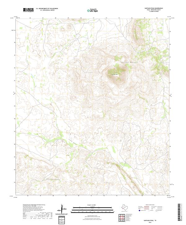
2022 Map of Santiago Peak
USGS Topo · Published 2022About this map
Santiago Peak dominates this Brewster County landscape, rising prominently as the central topographical landmark within the Santiago Mountains. This modern survey illustrates the dramatic elevation changes and geological formations of West Texas, including the southern extension of the range toward the Chalk Mountains. The hydrology of the area is defined by seasonal watercourses, most notably Chalk Draw and Calamity Cr, which carve through the arid terrain. The map's contour lines provide a detailed reading of the volcanic and sedimentary features that define this high-desert environment, showing the natural corridors used for travel and drainage long before modern roads were established.
Find a feature on this map
5 named features on this map. Tap any name to fly to it.
Don’t see what you’re looking for? This feature index may not catch every label — zoom into the map to look around manually.
Map Details
Editions of this 2022 Santiago Peak Map
This is the sole edition of this map. No revisions or reprints were ever made.
Other maps of this area

1917 · Agua Fria
USGS Topo · 1:62,500

1917 · Santiago Peak
USGS Topo · 1:62,500

1917 · Buck Hill
USGS Topo · 1:62,500

1918 · Bone Spring
USGS Topo · 1:125,000

1918 · Buck Hill
USGS Topo · 1:62,500

1918 · Santiago Peak
USGS Topo · 1:62,500

1918 · Nine Point Mesa
USGS Topo · 1:62,500

1925 · Buck Hill
USGS Topo · 1:62,500

1937 · Nine Point Mesa
USGS Topo · 1:62,500

1937 · Agua Fria
USGS Topo · 1:62,500