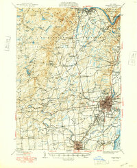
1949 Map of Saratoga
USGS Topo · Published 1949About this map
Ballston Spa and the City of Saratoga Springs anchor this post-war landscape, where established resort and racing traditions meet the industrial and agricultural corridors of the Kayadrosseras Range. The map highlights the region's diverse identity, from the sporting grounds of the Saratoga Track and Saratoga Raceway to the natural history preserved at Petrified Gardens and Lester Park. A dense network of rural schoolhouses, such as School No 11 and School No 5, points to the era's small-scale local districts before modern consolidation.
Find a feature on this map
140 named features on this map. Tap any name to fly to it.
Don’t see what you’re looking for? This feature index may not catch every label — zoom into the map to look around manually.
Map Details
Editions of this 1949 Saratoga Map
This is the sole edition of this map. No revisions or reprints were ever made.
Other maps of this area

1893 · Cohoes
USGS Topo · 1:62,500

1893 · Schenectady
USGS Topo · 1:62,500

1895 · Cohoes
USGS Topo · 1:62,500

1895 · Schenectady
USGS Topo · 1:62,500

1895 · Amsterdam
USGS Topo · 1:62,500

1895 · Glens Falls
USGS Topo · 1:62,500

1897 · Glens Falls
USGS Topo · 1:62,500

1898 · Schenectady
USGS Topo · 1:62,500

1898 · Cohoes
USGS Topo · 1:62,500

1899 · Broadalbin
USGS Topo · 1:62,500