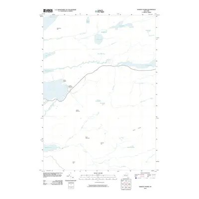
2010 Map of Sargent Ponds
USGS Topo · Published 2010About this map
Silver Beach sits on the eastern shore of Raquette Lake, serving as a central point of activity in this Adirondack landscape. The 2010 geography is dominated by a complex network of waterways, including the Marion River and Utowana Lake, which historically provided vital travel routes through the dense forest. To the south, Sagamore Lake and its associated drainage via Lost Brook define the lower reaches of the quadrangle. High ground is marked by prominent peaks such as Estelle Mountain, Buck Mountain, and the Blue Ridge. The presence of the Golden Beach State Campground reflects the modern recreational utility of the area, while smaller water bodies like Slim Pond and Bear Pond highlight the intricate, unfragmented nature of the interior hydrology.
Find a feature on this map
32 named features on this map. Tap any name to fly to it.
Don’t see what you’re looking for? This feature index may not catch every label — zoom into the map to look around manually.
Map Details
Editions of this 2010 Sargent Ponds Map
This is the sole edition of this map. No revisions or reprints were ever made.
Other maps of this area

1899 · Indian Lake
USGS Topo · 1:62,500

1900 · Canada Lake
USGS Topo · 1:62,500

1902 · Indian Lake
USGS Topo · 1:62,500

1903 · West Canada Lakes
USGS Topo · 1:62,500

1903 · Raquette Lake
USGS Topo · 1:62,500

1903 · Blue Mountain
USGS Topo · 1:62,500

1950 · Utica
USGS Topo · 1:250,000

1954 · Blue Mountain
USGS Topo · 1:62,500

1954 · Indian Lake
USGS Topo · 1:62,500

1954 · West Canada Lakes
USGS Topo · 1:62,500