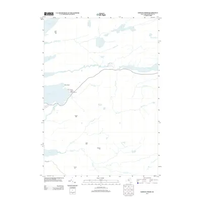
2013 Map of Sargent Ponds
USGS Topo · Published 2013About this map
Silver Beach serves as a focal point for settlement and recreation in this high-resolution study of the Central Adirondack wilderness. The landscape is defined by its intricate drainage networks, where the Marion River connects Raquette Lake to the elongated basin of Utowana Lake. To the south, high points such as Estelle Mtn, Buck Mtn, and Squirrel Top overlook a series of secluded water bodies, including Slim Pond and Sagamore Lake. Public land use is documented along the western shore, specifically at the Golden Beach State Campground, reached via State Park Rd. The map illustrates a contemporary balance between remote natural features like Death Brook and Loon Brook and the managed access points that characterize this region of Hamilton County, providing a clear record of the area's geography and water-level topography.
Find a feature on this map
31 named features on this map. Tap any name to fly to it.
Don’t see what you’re looking for? This feature index may not catch every label — zoom into the map to look around manually.
Map Details
Editions of this 2013 Sargent Ponds Map
This is the sole edition of this map. No revisions or reprints were ever made.
Other maps of this area

1899 · Indian Lake
USGS Topo · 1:62,500

1900 · Canada Lake
USGS Topo · 1:62,500

1902 · Indian Lake
USGS Topo · 1:62,500

1903 · West Canada Lakes
USGS Topo · 1:62,500

1903 · Raquette Lake
USGS Topo · 1:62,500

1903 · Blue Mountain
USGS Topo · 1:62,500

1950 · Utica
USGS Topo · 1:250,000

1954 · Blue Mountain
USGS Topo · 1:62,500

1954 · Indian Lake
USGS Topo · 1:62,500

1954 · West Canada Lakes
USGS Topo · 1:62,500