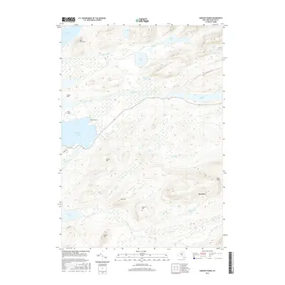
2016 Map of Sargent Ponds
USGS Topo · Published 2016About this map
The Marion River winds through this Adirondack landscape, connecting the expansive Utowana Lake to South Bay Raquette Lake. This waterway was a vital link for seasonal travelers and wilderness guides long before modern roads reached these interior reaches of Hamilton County. The terrain is defined by significant elevations such as Blue Ridge, Estelle Mtn, and Buck Mtn, while the lower basins are filled with a network of glacial waters including Lower Pond, Middle Pond, and Upper Pond. Evidence of localized settlement and recreation is visible at Silver Beach and along Burkes Rd. To the south, the area around Sagamore Lake and Aluminum Pond sits beneath the heights of Squirrel Top and Green Top, illustrating the dense topographical relief that has historically separated these pockets of wilderness from more developed regions like Speculator.
Find a feature on this map
33 named features on this map. Tap any name to fly to it.
Don’t see what you’re looking for? This feature index may not catch every label — zoom into the map to look around manually.
Map Details
Editions of this 2016 Sargent Ponds Map
This is the sole edition of this map. No revisions or reprints were ever made.
Other maps of this area

1899 · Indian Lake
USGS Topo · 1:62,500

1900 · Canada Lake
USGS Topo · 1:62,500

1902 · Indian Lake
USGS Topo · 1:62,500

1903 · West Canada Lakes
USGS Topo · 1:62,500

1903 · Raquette Lake
USGS Topo · 1:62,500

1903 · Blue Mountain
USGS Topo · 1:62,500

1950 · Utica
USGS Topo · 1:250,000

1954 · Blue Mountain
USGS Topo · 1:62,500

1954 · Indian Lake
USGS Topo · 1:62,500

1954 · West Canada Lakes
USGS Topo · 1:62,500