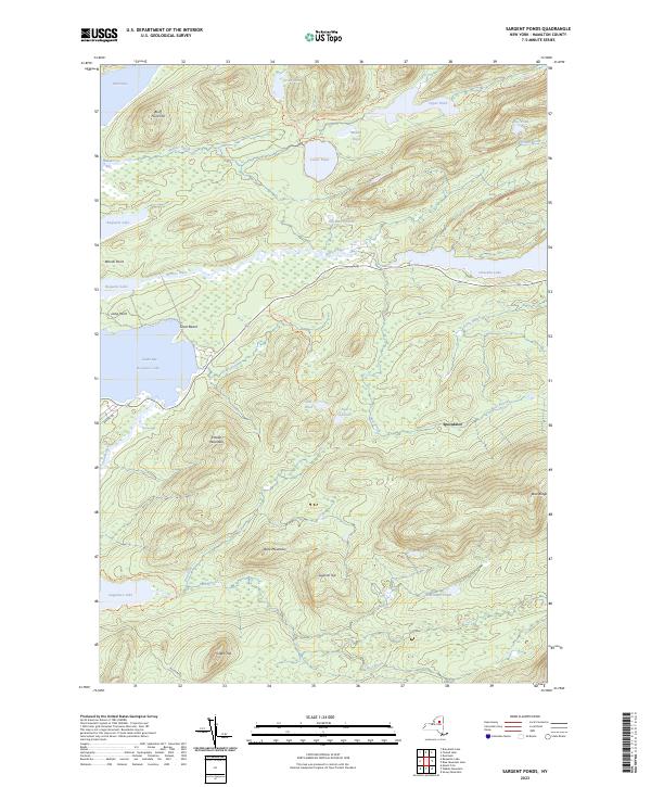
2023 Map of Sargent Ponds
USGS Topo · Published 2023About this map
Speculator and the expansive waters of Raquette Lake anchor this 2023 survey of the Adirondack wilderness. The map documents a complex network of glacial ponds and interconnecting waterways, including the Marion River which flows between Raquette Lake and Utowana Lake. To the south, Sagamore Lake sits near the headwaters of the South Inlet, surrounded by significant terrain features like Estelle Mountain and Buck Mountain.
Find a feature on this map
41 named features on this map. Tap any name to fly to it.
Don’t see what you’re looking for? This feature index may not catch every label — zoom into the map to look around manually.
Map Details
Editions of this 2023 Sargent Ponds Map
This is the sole edition of this map. No revisions or reprints were ever made.
Other maps of this area

1899 · Indian Lake
USGS Topo · 1:62,500

1900 · Canada Lake
USGS Topo · 1:62,500

1902 · Indian Lake
USGS Topo · 1:62,500

1903 · West Canada Lakes
USGS Topo · 1:62,500

1903 · Raquette Lake
USGS Topo · 1:62,500

1903 · Blue Mountain
USGS Topo · 1:62,500

1950 · Utica
USGS Topo · 1:250,000

1954 · Blue Mountain
USGS Topo · 1:62,500

1954 · Indian Lake
USGS Topo · 1:62,500

1954 · West Canada Lakes
USGS Topo · 1:62,500