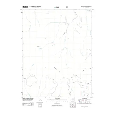
2011 Map of Sargents Mesa
USGS Topo · Published 2011About this map
Sargents Mesa and the Cochetopa Hills dominate this high-altitude landscape in Saguache County, where a complex network of alpine drainage systems defines the terrain. The hydrological patterns are particularly striking, with the Long Branch collecting waters from the Baldy Branch and Lake Branch near the prominent Long Branch Baldy. To the south, the topography shifts toward steep drainages like Houghland Gulch and Jacks Creek, which feed into larger systems such as Vulcan Creek. This 2011 survey captures the area’s reliance on primitive access routes like Co Rd 31xx and RD 32 JJ, essential for navigating the high parks and mesas. Small alpine features like Baldy Lake and the open meadow of Firebox Park provide specific landmarks within this expansive drainage basin of the West Fork Long Branch Tomichi Creek.
Find a feature on this map
28 named features on this map. Tap any name to fly to it.
Don’t see what you’re looking for? This feature index may not catch every label — zoom into the map to look around manually.
Map Details
Editions of this 2011 Sargents Mesa Map
This is the sole edition of this map. No revisions or reprints were ever made.
Other maps of this area

1956 · Montrose
USGS Topo · 1:250,000

1959 · Montrose
USGS Topo · 1:250,000

1960 · Montrose
USGS Topo · 1:250,000

1962 · Doyleville
USGS Topo · 1:24,000

1962 · West Baldy
USGS Topo · 1:24,000

1964 · Sargents
USGS Topo · 1:24,000
1967 · North Pass
USGS Topo · 1:24,000

1967 · Sargents Mesa
USGS Topo · 1:24,000

1967 · Trickle Mountain
USGS Topo · 1:24,000

1967 · Lake Mountain NE
USGS Topo · 1:24,000