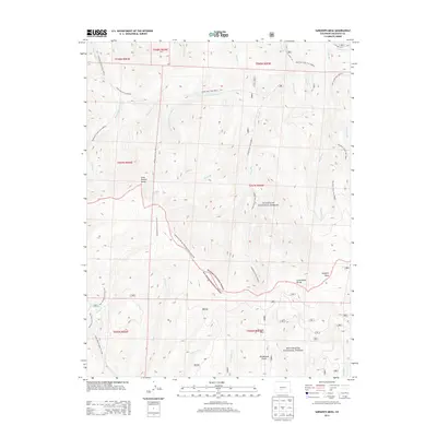
2013 Map of Sargents Mesa
USGS Topo · Published 2013About this map
The Continental Divide serves as the literal and metaphorical center of this landscape, carving a boundary between the Gunnison National Forest and the Rio Grande National Forest. This high-altitude terrain is defined by its water systems and peaks, notably Long Branch Baldy and the broad expanse of Sargents Mesa. The map provides a detailed view of a complex trail network, including the Continental Divide National Scenic Trail NST and numerous drainage-aligned routes like Long Branch Trail 9489.0 and Dutchman Creek Trail 9490.0. Small mountain catchments and clearings, such as Baldy Lake and Firebox Park, punctuate the heavily forested slopes. These features reflect a legacy of land management and recreational use in the Colorado high country, where the geography is etched by namesake drainages like Dutchman Cr and Spruce Cr.
Find a feature on this map
46 named features on this map. Tap any name to fly to it.
Don’t see what you’re looking for? This feature index may not catch every label — zoom into the map to look around manually.
Map Details
Editions of this 2013 Sargents Mesa Map
This is the sole edition of this map. No revisions or reprints were ever made.
Other maps of this area

1956 · Montrose
USGS Topo · 1:250,000

1959 · Montrose
USGS Topo · 1:250,000

1960 · Montrose
USGS Topo · 1:250,000

1962 · Doyleville
USGS Topo · 1:24,000

1962 · West Baldy
USGS Topo · 1:24,000

1964 · Sargents
USGS Topo · 1:24,000
1967 · North Pass
USGS Topo · 1:24,000

1967 · Sargents Mesa
USGS Topo · 1:24,000

1967 · Trickle Mountain
USGS Topo · 1:24,000

1967 · Lake Mountain NE
USGS Topo · 1:24,000