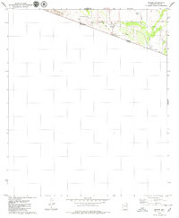
1979 Map of Sasabe
USGS Topo · Published 1979About this map
The Arizona Sonora border defines the character of this late-1970s topographical record, where the international boundary between the United States and Mexico cuts sharply across the desert floor. The small community of Sasabe serves as a focal point, anchored by the U.S. Customs station and connected to the north by Highway 286. This landscape is one of intermittent water and isolated ranching outposts, including the sprawling Rancho de la Osa and the distant Garcia Ranch to the southeast. The terrain rises to the west into the Pozo Verde Mts, while the lowlands are carved by the Arroyo del Sasabe and La Osa Wash. These ephemeral watercourses and scattered improvements like La Osa Tank reflect the necessity of water management in a region where cattle ranching and international transit were the primary drivers of settlement and activity.
Find a feature on this map
13 named features on this map. Tap any name to fly to it.
Don’t see what you’re looking for? This feature index may not catch every label — zoom into the map to look around manually.
Map Details
Editions of this 1979 Sasabe Map
3 editions found
Other maps of this area

1920 · Arivaca
USGS Topo · 1:125,000

1921 · Old Glory
USGS Topo · 1:125,000

1941 · Presumido Peak
USGS Topo · 1:62,500

1941 · Arivaca
USGS Topo · 1:62,500

1942 · Oro Blanco
USGS Topo · 1:62,500

1943 · Fresnal
USGS Topo · 1:125,000

1943 · Arivaca
USGS Topo · 1:62,500

1943 · Old Glory
USGS Topo · 1:125,000

1943 · Presumido Peak
USGS Topo · 1:62,500

1944 · Oro Blanco
USGS Topo · 1:62,500