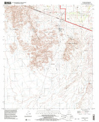
1996 Map of Sasabe
USGS Topo · Published 2003About this map
Rancho de la Osa and the international border crossing at Sasabe define this desert landscape in the late 1990s. The map illustrates a transborder community where settlements like Chihuahua and El Sasabe sit just south of the line, while the Buenos Aires National Wildlife Refuge occupies the northern flats. The terrain is dominated by the Sierra Pozo Verde, with the Pozo Verde Mts providing a sharp contrast to the drainage of the Arroyo del Sasabe. Grounded in ranching and border commerce, the map identifies specific local sites including the U.S. Customs post, a rural Cemetery, and several smaller outposts like Aduana and Garcia Ranch. The presence of an Aqueduct and scattered water features like La Osa Tank underscore the critical role of water management in this arid environment.
Find a feature on this map
40 named features on this map. Tap any name to fly to it.
Don’t see what you’re looking for? This feature index may not catch every label — zoom into the map to look around manually.
Map Details
Editions of this 1996 Sasabe Map
This is the sole edition of this map. No revisions or reprints were ever made.
Other maps of this area

1920 · Arivaca
USGS Topo · 1:125,000

1921 · Old Glory
USGS Topo · 1:125,000

1941 · Presumido Peak
USGS Topo · 1:62,500

1941 · Arivaca
USGS Topo · 1:62,500

1942 · Oro Blanco
USGS Topo · 1:62,500

1943 · Fresnal
USGS Topo · 1:125,000

1943 · Arivaca
USGS Topo · 1:62,500

1943 · Old Glory
USGS Topo · 1:125,000

1943 · Presumido Peak
USGS Topo · 1:62,500

1944 · Oro Blanco
USGS Topo · 1:62,500