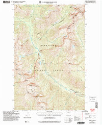
2004 Map of Saska Peak
USGS Topo · Published 2008About this map
The Chelan Mountains and Entiat Mountains converge in this high-altitude landscape within the Wenatchee National Forest. Centered on the towering Saska Peak, the map reveals a complex network of alpine basins and ridges that feed the headwaters of the Entiat River. Notable landmarks such as Saska Pass and Borealis Pass provide a glimpse into the topographical barriers that historically isolated these remote drainages.
Find a feature on this map
48 named features on this map. Tap any name to fly to it.
Don’t see what you’re looking for? This feature index may not catch every label — zoom into the map to look around manually.
Map Details
Editions of this 2004 Saska Peak Map
This is the sole edition of this map. No revisions or reprints were ever made.
Other maps of this area

1901 · Chiwaukum
USGS Topo · 1:125,000

1902 · Stehekin
USGS Topo · 1:125,000

1904 · Stehekin
USGS Topo · 1:125,000

1904 · Chiwaukum
USGS Topo · 1:125,000

1944 · Holden
USGS Topo · 1:62,500

1944 · Lucerne
USGS Topo · 1:62,500

1949 · Lucerne
USGS Topo · 1:62,500

1949 · Holden
USGS Topo · 1:62,500

1955 · Concrete
USGS Topo · 1:250,000

1957 · Wenatchee
USGS Topo · 1:250,000