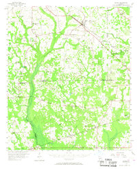
1956 Map of Sasser
USGS Topo · Published 1968About this map
Sasser serves as a primary junction in the mid-1950s, where the Seaboard railroad intersects the Franklin D Roosevelt Highway and Air Line Highway. The surrounding landscape is defined by the extensive drainage systems of Chickasawhatchee Creek and Kiokee Creek, which support a rural network of small communities and social centers. These hubs are anchored by local institutions such as Clarks Mill and the Andrew Jackson Historical Monument, alongside numerous country schools like the Laing Sch and Dunbar Sch.
Find a feature on this map
65 named features on this map. Tap any name to fly to it.
Don’t see what you’re looking for? This feature index may not catch every label — zoom into the map to look around manually.
Map Details
Editions of this 1956 Sasser Map
2 editions found
Other maps of this area

1953 · Dothan
USGS Topo · 1:250,000

1954 · Dothan
USGS Topo · 1:250,000

1955 · Dothan
USGS Topo · 1:250,000

1956 · Albany West
USGS Topo · 1:24,000

1956 · Baconton
USGS Topo · 1:62,500

1956 · Newton
USGS Topo · 1:62,500

1956 · Sasser
USGS Topo · 1:62,500

1956 · Albany
USGS Topo · 1:62,500

1956 · Leslie
USGS Topo · 1:62,500

1972 · Shellman
USGS Topo · 1:24,000