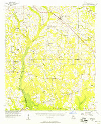
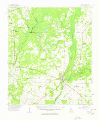
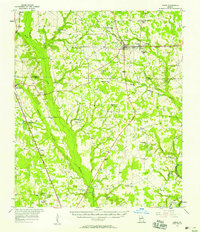
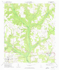
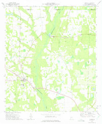
1956 Map of Sasser
USGS Topo · Published 1958About this map
Sasser and the surrounding farm country in southwest Georgia appear here in the mid-1950s, defined by a dense network of rural churches and schools. The landscape is carved by the extensive wetlands of Chickasawhatchee Creek and its tributaries like Tallahasee Creek and Kiokee Creek. These swampy corridors influenced the layout of early roads and rail lines, including the Seaboard Air Line Railroad and the Central of Georgia Railroad.
Find a feature on this map
67 named features on this map. Tap any name to fly to it.
Don’t see what you’re looking for? This feature index may not catch every label — zoom into the map to look around manually.
Map Details
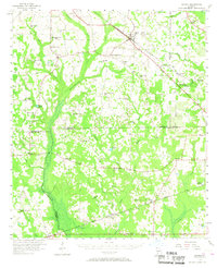
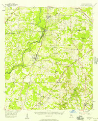
Editions of this 1956 Sasser Map
2 editions found
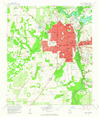
Other maps of this area

1953 · Dothan
USGS Topo · 1:250,000

1954 · Dothan
USGS Topo · 1:250,000

1955 · Dothan
USGS Topo · 1:250,000
1956 · Albany West
USGS Topo · 1:24,000
1956 · Baconton
USGS Topo · 1:62,500
1956 · Newton
USGS Topo · 1:62,500

1956 · Albany
USGS Topo · 1:62,500
1956 · Leslie
USGS Topo · 1:62,500
1972 · Shellman
USGS Topo · 1:24,000
1973 · Morgan
USGS Topo · 1:24,000