
1956 Map of Newton
USGS Topo · Published 1958About this map
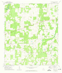
Newton serves as the focal point of this mid-century landscape, situated along the banks of the Flint River where the Courthouse and a local High Sch anchor the community. The surrounding Baker County countryside is a dense network of family-named landmarks and rural congregations, including Mole Grove Ch, Chapel Hill Ch, and the Zion Grove Cem. The northern reach of the map is defined by the Central of Georgia railroad line passing through Bermuda, while the lower sections feature agricultural hubs like Elmodel and Red Store Crossroads. A complex system of waterways, from the Chickasawhatchee Creek to the swampy margins of Cooleewahee Creek, dictates the placement of these early settlements and road networks. The distribution of small cemeteries like Whitehill Cem and Travelers Rest Cem offers a detailed view of the area's genealogical history before significant modern land consolidation.
Find a feature on this map
46 named features on this map. Tap any name to fly to it.
Don’t see what you’re looking for? This feature index may not catch every label — zoom into the map to look around manually.
Map Details
Editions of this 1956 Newton Map
This is the sole edition of this map. No revisions or reprints were ever made.
Other maps of this area

1953 · Dothan
USGS Topo · 1:250,000

1954 · Dothan
USGS Topo · 1:250,000

1955 · Dothan
USGS Topo · 1:250,000

1956 · Albany West
USGS Topo · 1:24,000

1956 · Baconton
USGS Topo · 1:62,500

1956 · Sasser
USGS Topo · 1:62,500

1956 · Albany
USGS Topo · 1:62,500

1971 · Camilla
USGS Topo · 1:24,000

1971 · Hopeful
USGS Topo · 1:24,000
1971 · Branchville
USGS Topo · 1:24,000