
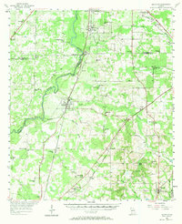
1956 Map of Baconton
USGS Topo · Published 1957About this map
The Flint River carves a winding path through the heart of this southwest Georgia landscape, defining the borders between Baker, Dougherty, and Mitchell counties. This mid-century survey captures a network of rural communities and rail lines, including the Atlantic Coast Line and the Georgia Northern railroad. Small towns like Baconton and Sale City serve as local hubs, while the map reveals an extensive system of country churches and family burial grounds that anchor the rural social fabric.
Find a feature on this map
64 named features on this map. Tap any name to fly to it.
Don’t see what you’re looking for? This feature index may not catch every label — zoom into the map to look around manually.
Map Details
Editions of this 1956 Baconton Map
2 editions found
Other maps of this area

1953 · Dothan
USGS Topo · 1:250,000

1953 · Waycross
USGS Topo · 1:250,000

1954 · Dothan
USGS Topo · 1:250,000

1955 · Dothan
USGS Topo · 1:250,000

1956 · Albany East
USGS Topo · 1:24,000

1956 · Albany West
USGS Topo · 1:24,000

1956 · Newton
USGS Topo · 1:62,500

1956 · Sylvester
USGS Topo · 1:62,500

1956 · Sasser
USGS Topo · 1:62,500

1956 · Doerun
USGS Topo · 1:62,500