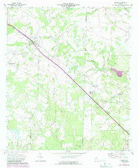
1973 Map of Sasser
USGS Topo · Published 1988About this map
Sasser serves as the focal point of this Southwest Georgia landscape, where the Central of Georgia railroad cuts a diagonal line through the agricultural terrain. The settlement pattern is defined by rural crossroads and small communities like Armena, Oakland, and Chickasawhatchee, each anchored by a network of local institutions. For those tracing family histories, the presence of Macedonia Ch and its associated Macedonia Cem, along with Mt Olive Ch and Mt Zion Ch, indicates the deep-rooted social fabric of these Terrell County communities.
Find a feature on this map
22 named features on this map. Tap any name to fly to it.
Don’t see what you’re looking for? This feature index may not catch every label — zoom into the map to look around manually.
Map Details
Editions of this 1973 Sasser Map
2 editions found
Other maps of this area

1953 · Dothan
USGS Topo · 1:250,000

1954 · Dothan
USGS Topo · 1:250,000

1955 · Dothan
USGS Topo · 1:250,000

1956 · Albany West
USGS Topo · 1:24,000

1956 · Sasser
USGS Topo · 1:62,500

1956 · Albany
USGS Topo · 1:62,500

1956 · Leslie
USGS Topo · 1:62,500

1973 · Chickasawhatchee
USGS Topo · 1:24,000

1973 · Sasser
USGS Topo · 1:24,000

1973 · Pretoria
USGS Topo · 1:24,000