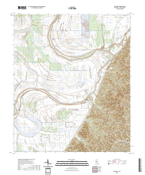
2024 Map of Satartia
USGS Topo · Published 2024About this map
The Yazoo River defines the landscape of this region, winding in deep oxbows across the floodplains toward Satartia. This area of Yazoo County exhibits a sharp transition between the low-lying alluvial delta and the rising bluffs to the southeast, where the settlement of Mechanicsburg is situated. The map provides significant detail for genealogists, marking several legacy burial sites including the Hamberlin Family Cem, McLeod Cem, and Henry Cem.
Find a feature on this map
42 named features on this map. Tap any name to fly to it.
Don’t see what you’re looking for? This feature index may not catch every label — zoom into the map to look around manually.
Map Details
Editions of this 2024 Satartia Map
This is the sole edition of this map. No revisions or reprints were ever made.
Other maps of this area

1940 · Mechanicsburg
USGS Topo · 1:62,500

1955 · Jackson
USGS Topo · 1:250,000

1961 · Jackson
USGS Topo · 1:250,000

1961 · Bayland
USGS Topo · 1:62,500

1961 · Valley
USGS Topo · 1:62,500

1962 · Jackson
USGS Topo · 1:250,000

1962 · Flora
USGS Topo · 1:62,500

1963 · Mechanicsburg
USGS Topo · 1:62,500

1984 · Yazoo City
USGS Topo · 1:100,000
1988 · Lucre
USGS Topo · 1:24,000