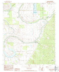
1988 Map of Satartia
USGS Topo · Published 1988About this map
The Yazoo River winds prominently through this late-1980s landscape, illustrating the complex hydrology of the Mississippi Delta region. At the foot of the bluffs where the hills meet the floodplain, the village of Satartia serves as a focal point, established along the river's serpentine path. The contrast between the flat alluvial plain to the west and the dissected uplands to the east is sharp, with the eastern hills housing the community of Mechanicsburg and the winding Beaver Creek.
Find a feature on this map
18 named features on this map. Tap any name to fly to it.
Don’t see what you’re looking for? This feature index may not catch every label — zoom into the map to look around manually.
Map Details
Editions of this 1988 Satartia Map
This is the sole edition of this map. No revisions or reprints were ever made.
Other maps of this area

1940 · Mechanicsburg
USGS Topo · 1:62,500

1955 · Jackson
USGS Topo · 1:250,000

1961 · Jackson
USGS Topo · 1:250,000

1961 · Bayland
USGS Topo · 1:62,500

1961 · Valley
USGS Topo · 1:62,500

1962 · Jackson
USGS Topo · 1:250,000

1962 · Flora
USGS Topo · 1:62,500

1963 · Mechanicsburg
USGS Topo · 1:62,500

1984 · Yazoo City
USGS Topo · 1:100,000
1988 · Lucre
USGS Topo · 1:24,000