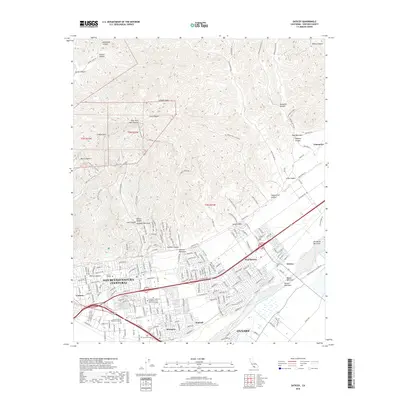
2018 Map of Saticoy
USGS Topo · Published 2018About this map
San Buenaventura (Ventura) and its surrounding agricultural valleys are showcased in this 2018 survey, illustrating the dense suburban expansion of eastern Ventura toward the Santa Clara River. The landscape transitions from the concentrated residential streets of Montalvo and Kimball into the deeply furrowed canyons of the north, including Sexton Canyon and Harmon Canyon. These geographical features define the northern boundary of the urban area, with numerous barrancas like Arundell Barranca and Harmon Barranca channeling drainage from the hills toward the coastal plain.
Find a feature on this map
200 named features on this map. Tap any name to fly to it.
Don’t see what you’re looking for? This feature index may not catch every label — zoom into the map to look around manually.
Map Details
Editions of this 2018 Saticoy Map
This is the sole edition of this map. No revisions or reprints were ever made.
Other maps of this area

1903 · Santa Paula
USGS Topo · 1:62,500

1904 · Ventura
USGS Topo · 1:62,500

1904 · Hueneme
USGS Topo · 1:62,500

1941 · Ventura
USGS Topo · 1:62,500

1942 · Santa Paula
USGS Topo · 1:62,500

1942 · Hueneme
USGS Topo · 1:62,500

1943 · Hueneme
USGS Topo · 1:62,500

1947 · Santa Paula
USGS Topo · 1:62,500

1949 · Los Angeles
USGS Topo · 1:250,000

1949 · Oxnard
USGS Topo · 1:24,000