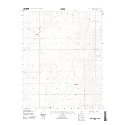
2013 Map of Sauble Circle Dot Ranch
USGS Topo · Published 2013About this map
Sauble Circle Dot Ranch and neighboring livestock operations define this high-plains landscape in northeastern New Mexico. This 2013 survey documents a remote ranching territory where water dictates the patterns of settlement, primarily concentrated around Rio del Plano and the drainage of Chico Cr. The terrain is characterized by the prominent Jumping Divide and the broad slopes of Gillespie to the south. Transportation in this corner of Colfax County relies on a network of unpaved tracks such as Chico Rd and Dry Gulch Rd, connecting isolated homesteads like Langely Ranch and the locality of Gillespie Ranch. The map provides a clear view of the Public Land Survey System divisions, including sections within t26n r24e and t26n r25e.
Find a feature on this map
17 named features on this map. Tap any name to fly to it.
Don’t see what you’re looking for? This feature index may not catch every label — zoom into the map to look around manually.
Map Details
Editions of this 2013 Sauble Circle Dot Ranch Map
This is the sole edition of this map. No revisions or reprints were ever made.
Other maps of this area

1954 · Raton
USGS Topo · 1:250,000

1958 · Raton
USGS Topo · 1:250,000

1965 · Sauble Circle Dot Ranch
USGS Topo · 1:24,000

1965 · Abbott NW
USGS Topo · 1:24,000

1965 · Taylor Springs
USGS Topo · 1:24,000

1965 · Abbott
USGS Topo · 1:24,000

1971 · Tres Hermanos Peak
USGS Topo · 1:24,000
1971 · Loco Arroyo
USGS Topo · 1:24,000

1971 · Pine Buttes
USGS Topo · 1:24,000

1974 · Point Of Rocks Mesa
USGS Topo · 1:24,000