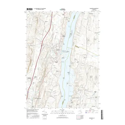
2016 Map of Saugerties
USGS Topo · Published 2016About this map
Esopus Creek flows into the Hudson River at Saugerties, creating a distinctive riverfront geography marked by Washburns Point and Rock Island. This modern survey reveals a landscape where historical riverside settlements like Malden-on-Hudson and Glasco remain defined by their proximity to the water's edge and the surrounding hills of Mt Marion and Mt Airy. The map provides significant detail for genealogists, documenting a dense concentration of burial grounds including Saint Marys Cem, Trinity Cem, and Old Red-Madalin Church Cem. On the eastern shore, the academic influence of Bard College and the Unification Theological Seminary shapes the character of Annandale-on-Hudson and Barrytown. The terrain is characterized by numerous river features like Skillpot Island and Cruger Island, alongside the tidal dynamics of North Bay and South Bay, illustrating the enduring relationship between these Hudson Valley communities and the river.
Find a feature on this map
180 named features on this map. Tap any name to fly to it.
Don’t see what you’re looking for? This feature index may not catch every label — zoom into the map to look around manually.
Map Details
Editions of this 2016 Saugerties Map
This is the sole edition of this map. No revisions or reprints were ever made.
Other maps of this area

1892 · Kaaterskill
USGS Topo · 1:62,500

1893 · Kaaterskill
USGS Topo · 1:62,500

1894 · Kaaterskill
USGS Topo · 1:62,500

1895 · Catskill
USGS Topo · 1:62,500

1898 · Rhinebeck
USGS Topo · 1:62,500

1899 · Kaaterskill
USGS Topo · 1:62,500

1901 · Rosendale
USGS Topo · 1:62,500

1903 · Rosendale
USGS Topo · 1:62,500

1903 · Kaaterskill
USGS Topo · 1:62,500

1934 · Rhinebeck
USGS Topo · 1:48,000