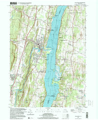
1997 Map of Saugerties
USGS Topo · Published 2000About this map
The Hudson River serves as the central artery for this late-20th-century landscape, dividing the riverfront communities of Saugerties and Malden-on-Hudson from the historic estates of the eastern bank. On the Columbia County side, the Clermont State Historic Site preserves a long legacy of land ownership, while the educational campus of Bard College anchors Annandale-on-Hudson to the south near South Bay.
Find a feature on this map
84 named features on this map. Tap any name to fly to it.
Don’t see what you’re looking for? This feature index may not catch every label — zoom into the map to look around manually.
Map Details
Editions of this 1997 Saugerties Map
This is the sole edition of this map. No revisions or reprints were ever made.
Other maps of this area

1892 · Kaaterskill
USGS Topo · 1:62,500

1893 · Kaaterskill
USGS Topo · 1:62,500

1894 · Kaaterskill
USGS Topo · 1:62,500

1895 · Catskill
USGS Topo · 1:62,500

1898 · Rhinebeck
USGS Topo · 1:62,500

1899 · Kaaterskill
USGS Topo · 1:62,500

1901 · Rosendale
USGS Topo · 1:62,500

1903 · Rosendale
USGS Topo · 1:62,500

1903 · Kaaterskill
USGS Topo · 1:62,500

1934 · Rhinebeck
USGS Topo · 1:48,000