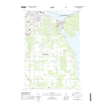
2019 Map of Sault Ste. Marie South
USGS Topo · Published 2019About this map
Sault Ste. Marie serves as a busy international gateway along the Saint Marys River, where the southern expansion of the city meets the edge of the Hiawatha National Forest. This mapping of the eastern Upper Peninsula illustrates a landscape defined by its relation to the water, from the complex network of islands like Sugar Island and Rotary Island to the distinct Little Rapids Channel. The urban grid transitions from the historic Chippewa County Courthouse and Lake Superior State University southward into agricultural tracts and woodlots.
Find a feature on this map
119 named features on this map. Tap any name to fly to it.
Don’t see what you’re looking for? This feature index may not catch every label — zoom into the map to look around manually.
Map Details
Editions of this 2019 Sault Ste. Marie South Map
This is the sole edition of this map. No revisions or reprints were ever made.
Other maps of this area

1913 · Sault Sainte Marie
USGS Topo · 1:62,500

1919 · Neebish
USGS Topo · 1:62,500

1941 · Neebish
USGS Topo · 1:63,360

1941 · Sault Sainte Marie
USGS Topo · 1:63,360

1951 · Shallows
USGS Topo · 1:24,000

1951 · Dafter
USGS Topo · 1:24,000

1951 · Barbeau
USGS Topo · 1:24,000

1951 · Baie De Wasai
USGS Topo · 1:24,000

1951 · Oak Ridge
USGS Topo · 1:24,000

1951 · Sault Ste. Marie
USGS Topo · 1:62,500