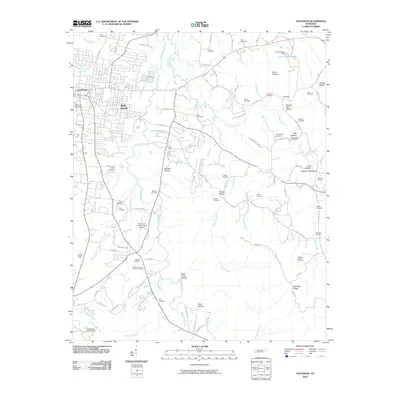
2010 Map of Savannah
USGS Topo · Published 2010About this map
Savannah serves as the regional hub in this Hardin County landscape, where modern infrastructure like the Savannah-Hardin County Airport and residential areas like Belle Meade contrast with a dense network of ancestral sites. The terrain is defined by a series of narrow valleys including Godwin Mill Hollow, Mozier Mill Hollow, and Bull Hollow, suggesting a history of small-scale milling and homesteading along the many branches of Horse Creek and Turkey Creek. Genealogy researchers will find an exceptional number of burial grounds preserved here, from the larger Hardin County Memory Gardens to family-named sites like the Hosea Farm Cemetery, DeBerry Cemetery, and Boon Cemetery. The map also traces older settlement patterns near Old Town and the waters of Don Coleman Lake.
Find a feature on this map
103 named features on this map. Tap any name to fly to it.
Don’t see what you’re looking for? This feature index may not catch every label — zoom into the map to look around manually.
Map Details
Editions of this 2010 Savannah Map
This is the sole edition of this map. No revisions or reprints were ever made.
Other maps of this area

1936 · Savannah
USGS Topo · 1:24,000

1936 · Wolf Pit Ridge
USGS Topo · 1:24,000

1936 · Hookers Bend
USGS Topo · 1:24,000

1936 · Counce
USGS Topo · 1:24,000

1936 · Olivehill
USGS Topo · 1:24,000

1936 · Milledgeville
USGS Topo · 1:24,000

1936 · Pickwick
USGS Topo · 1:24,000

1936 · Lowryville
USGS Topo · 1:24,000

1936 · Pittsburg Landing
USGS Topo · 1:24,000

1949 · Hookers Bend
USGS Topo · 1:24,000