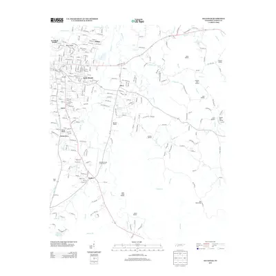
2013 Map of Savannah
USGS Topo · Published 2013About this map
Horse Creek and its many tributaries, including English Creek and Steele Creek, define the topography east of the Tennessee River in this 2013 survey. The landscape is a mix of expanding residential developments like Woodland Heights and Belle Meade alongside deeply etched terrain features such as Oxen Hollow and Godwin Mill Hollow. The map documents the local transportation network and aviation infrastructure at the Savannah-Hardin County Airport, situated south of the primary settlements. Smaller residential pockets like Walkertown, Maddox, and Austin are clustered along the highway corridors of Highway 69 and Highway 128. This modern record captures the transition from traditional hollow-and-ridge land use to a more connected suburban and regional hub, while naming family landmarks such as Don Coleman Lake and Bee Rock Ridge.
Find a feature on this map
69 named features on this map. Tap any name to fly to it.
Don’t see what you’re looking for? This feature index may not catch every label — zoom into the map to look around manually.
Map Details
Editions of this 2013 Savannah Map
This is the sole edition of this map. No revisions or reprints were ever made.
Other maps of this area

1936 · Savannah
USGS Topo · 1:24,000

1936 · Wolf Pit Ridge
USGS Topo · 1:24,000

1936 · Hookers Bend
USGS Topo · 1:24,000

1936 · Counce
USGS Topo · 1:24,000

1936 · Olivehill
USGS Topo · 1:24,000

1936 · Milledgeville
USGS Topo · 1:24,000

1936 · Pickwick
USGS Topo · 1:24,000

1936 · Lowryville
USGS Topo · 1:24,000

1936 · Pittsburg Landing
USGS Topo · 1:24,000

1949 · Hookers Bend
USGS Topo · 1:24,000