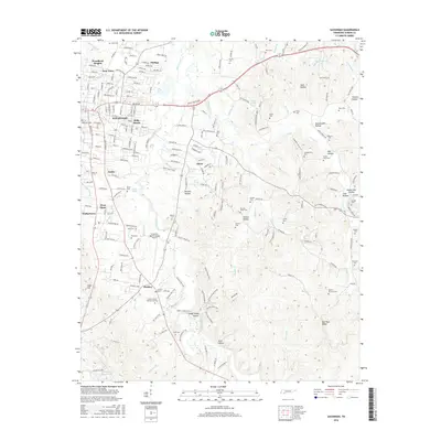
2016 Map of Savannah
USGS Topo · Published 2016About this map
Savannah serves as the focal point for this Hardin County landscape, where the Tennessee River corridor gives way to a network of creeks and named hollows. Residential growth is evident in neighborhoods like Woodland Heights, New Town, and Belle Meade, while the regional Savannah-Hardin County Airport anchors the central terrain. To the east, the topography becomes more complex, marked by features such as Godwin Mill Hollow and Oxen Hollow, which drain toward the winding paths of Turkey Creek and Horse Creek.
Find a feature on this map
87 named features on this map. Tap any name to fly to it.
Don’t see what you’re looking for? This feature index may not catch every label — zoom into the map to look around manually.
Map Details
Editions of this 2016 Savannah Map
This is the sole edition of this map. No revisions or reprints were ever made.
Other maps of this area

1936 · Savannah
USGS Topo · 1:24,000

1936 · Wolf Pit Ridge
USGS Topo · 1:24,000

1936 · Hookers Bend
USGS Topo · 1:24,000

1936 · Counce
USGS Topo · 1:24,000

1936 · Olivehill
USGS Topo · 1:24,000

1936 · Milledgeville
USGS Topo · 1:24,000

1936 · Pickwick
USGS Topo · 1:24,000

1936 · Lowryville
USGS Topo · 1:24,000

1936 · Pittsburg Landing
USGS Topo · 1:24,000

1949 · Hookers Bend
USGS Topo · 1:24,000